CURRANT CREEK
Heber City, Utah · USDA Forest Service
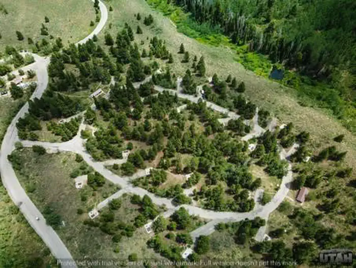
Photo: Recreation.gov
About
Currant Creek Campground sits next to Currant Creek Reservoir at an elevation of 8,000 feet. A wide variety of recreational activities awaits, including boating, fishing and hiking.Rainbow, cutthroat and brown trout fishing is a popular activity on the reservoir, as is canoeing, kayaking and boating. A boat ramp is located on-site. Numerous horseback riding, hiking and biking trails crisscross the area, including a nice loop around the reservoir. Currant Creek Trail begins in D Loop of the campground. For facility specific information, please call (385) 273-1100.This large campground provides group, equestrian, and single and double-family sites. A day-use area is on the lake shore and offers an accessible fishing dock and fish cleaning station. A small store is located at the campground entrance, with camping and fishing supplies, firewood, ice and limited food items. Campsites contain picnic tables, campfire rings, grills and cement site pads. Flush toilets, drinking water and a dump station are provided. The campground is situated on a hillside above the reservoir, among stands of aspen, fir and lodgepole pine trees, which offer partial shade. Summer wildflowers are plentiful. Deer and elk frequent the site, and nearly every campsite has scenic views of the reservoir and surrounding mountains.Race Track Creek Trailhead is just outside the campground. Coal Mine Hollow is just around the lake. Both offer off-road vehicle trail opportunities, hiking and fishing.
Directions
From Heber City, Utah, take Highway 40 east for 45 miles to the Currant Creek Junction. Turn off the highway and travel in a northwest direction approximately 17 miles to the campground. The road from the highway is paved for 10 miles and graded gravel for 7 miles. Stay on the most traveled road. When there are Y's in the road, stay on the road on the east side of Currant Creek, following the Creek to the dam. When you get to the dam, follow the road almost all the way around the reservoir, and you will find the campground near the southwest end of the lake, a short distance from the dam. Alternate Route: Take US Highway 40 from Heber City and travel approximately 22 miles southeast to FS Road 082 (Coop Creek Road). There is a Coop Creek sign on the north side of Highway 40. Turn north (left) at the sign and travel approximately 8 miles north. At that point there is another sign for Currant Creek Campground. Turn right at the sign and travel approximately 6 more miles east and south to the campground.
Location
Map tiles © OpenStreetMap.
Details
- State
- Utah
- City / area
- Heber City
- Agency
- USDA Forest Service
- Parent area
- Uinta-Wasatch-Cache National Forest
- Campsites
- 78
- Reservable
- Yes
- Typical price
- $30.14–$172.6 / night
- Rating
- 4.21 / 5 (129 reviews on Recreation.gov)
- Equipment
- Tent, RV, Trailer
Nearby campgrounds
- Currant Creek Guard Station (UT) 0.6 km away
- LODGEPOLE AT HEBER 16.5 km away · dump mentioned
- Soldier Creek Vacation Cabin 16.7 km away
- WOLF CREEK (UT) 17.1 km away
- MILL HOLLOW 18.2 km away
- Mill Hollow Guard Station 18.5 km away